Clouds 2
Altostratus
Week in Review
So this came out MUCH later than anticipated as I got distracted doing other things. Like worldbuilding. And work. Anyway, lots of more content planned for the future but I am only one human and clouds, as you all know, are complicated.
Thank you to all of you who have submitted your cloud photos! Some really amazing beauties in this week’s roundup. I was also privy to some wonderfully wooly clouds over the Shenandoah this weekend.
I am always looking for more cloud content. Email your best fluffy boys to me HERE!

The Altostratus Cloud
What goes into a cloud? Well, altostratus might give us a hint of that what (though the why remains consistently elusive). One might conceive of Altostratus as a “leveled up” version of their cousin, Stratus, as they form at the mid-altitude of the troposphere - that means anywhere between 6,500 and 23,000 feet. They are generally lighter in hue than Stratus clouds, and usually form a featureless sheet that could be anywhere from gray to blue-green in hue.
In terms of formation, Altostratus forms in a similar manner to Stratus: a large air mass, warm and humid, rises and depressurizes. Due to slightly colder air around it, or because the air mass has a higher dew point to begin with, it rises above the level of Stratus formation and into the mid-altitude layer, where water vapor condenses around cloud seeds.
Ta da! Altostratus is born!
They tend to keep their distance, and are not great at carrying a conversation. Indeed, perhaps the most interesting thing about Altostratus is their variants. One shared feature of note: Altostratus usually form ahead of a warm or occluded front. This brings us to our science lesson of the week: The Weather Front!
Weather Front: A boundary that separates air masses, each differing in their constituent parts (air density, wind, humidity, etc.), forming a transition zone between those air masses. This transition zone is the eponymous “front” of the weather, and the resulting turbulence can result in cloud and storm formations.
Air masses collide with each other as they are not static objects. High winds, like the Jet Streams, push air masses around the troposphere. Once these air masses collide, the same high winds push the resulting weather front along. If you want to learn more about weather fronts, and how they form, I recommend checking out these resources here.
There are four different types of weather fronts:
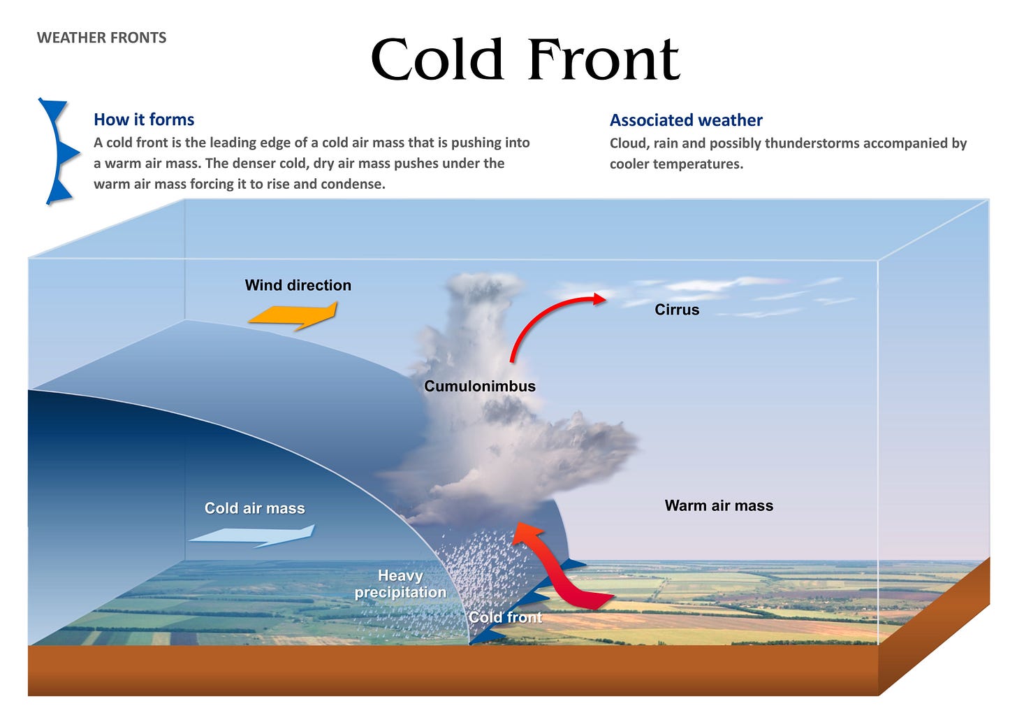
Cold Front: A cold air mass pushes into a warmer air mass, pushing the warm air higher up into the troposphere. This lifting can result in Cumulus or Cumulonimbus and their accompanying thunderstorms, for as the cold front passes, winds accelerate to gusts, temperature drops suddenly, and rains fall from the heavens. Sometimes Zeus might even huck a few lightning bolts!

Source: Tirine Educational Posters Warm Front: You guessed it: a warm air mass pushes into a cooler air mass, rising above the cold air and higher up into the troposphere. Warm fronts create similar effects to cold fronts: Cumulus or Cumulonimbus form and create storms. High and middle clouds often precede a warm front, quite literally the riders on the storm.

Source: Thomson Higher Education Stationary Front: Exactly what it sounds like, a weather front that does not move. This can happen for several reasons: 1) two air masses push against each other but neither is large enough or powerful enough to move the other, 2) winds blow parallel to each other instead of against each other, 3) both of these happening at the same time. Stationary fronts can remain in one place for days, and the difference in air temperature often results in clouds as well as rain or snow.

Source: Tirine Educational Posters Occluded Front: Cold fronts move faster than warm fronts, sometimes up to twice as fast. I suspect inertia is culpable, but I have not looked into the matter seriously. Because of this, a cold front can overtake a warm front. The scenario works something like this:
A warm air mass pushes into cold air mass 1, forming a warm front.
Cold air mass 2 pushes into the warm air mass from behind, forming a cold front.
Cold air mass 2 moves faster than the warm air mass, and so the cold front punches through the warm air mass and meets cold air mass 1, pushing the warm air up into the troposphere.
There are thus two different types of occluded fronts: a cold occlusion, where cold air mass 2 is colder than cold air mass 1 and thus pushes underneath both air masses; a warm occlusion, where cold air mass 2 is warmer than cold air mass 1 and thus rises over cold air mass 1 while lifting the warm air mass.
As you might have guessed, occluded fronts often result in precipitation from storm clouds, winds changes, and temperature shifts.

Source: Tirine Educational Posters
Time to bring it home. Altostratus form ahead of a warm front or occluded front as they are part of the warm air mass that rises / are pushed up into the mid-altitude of the troposphere. As such, it is easy to see why they often presage rain and stormy weather.
Variants
Altostratus does1 not have any subspecies of note, however, it does have quite a few varieties, some of which exhibit behavior that suggests ulterior motives. It strikes me that I switch between singular and On a separate note, I am not sure why there is a difference between “species” and “varieties”, but the distinction exists, and so we will roll with it until I am able to get to the bottom of which self-important meteorologist decided that the two should be distinct.
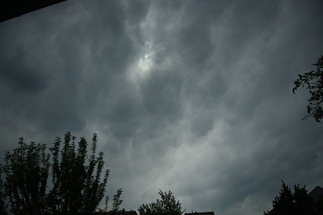
Altostratus Translucidus: A thin subset, such that the moon or sun is visible through it.
Altostratus Opacus: You guessed it: opaque Altostratus, which hides the sun and moon from us. A prime culprit for the SAD epidemic.
Altostratus Radiatus: Not a complete cloud, but when multiple Altostratus form parallel bands or strips.
Altostratus Duplicatus: A thicc Altostratus. That means it’s layered. Like a cheesecake.
Altostratus Undulatus: When seen from below, this Altostratus has a wavelike or undulating form. These names are so creative!
Altostratus Mamma: Bulbous protrusion, almost like the udders of cow, which hang down from the main body of the cloud. Usually occurs if the Altostratus is morphing into or from Altocumulus (more on those in a later post).
Altostratus Praecipitatio: Did you know praecipitatio is slang for precipitation that reaches the surface? Well, now you do. That’s what this cloud does.
Altostratus Virga: Virga are thin sheets of rain that do not touch the surface of the Earth; they evaporate before they have a chance to land. Poor things.
Mother Clouds
Altostratus has three mother cloud variants. Remember, cloud from which other clouds grow or form is known as a Mother Cloud (we covered them in Clouds 1).
Altostratus altocumulogenitus: When two Altocumulus get together and stay together, they form this cloud.
Altostratus cumulonimbogenitus: Like the above, but a divorce.
Altostratus cirrostratomutatus: Ahead of storms, Cirrostratus clouds thicken into Altostratus (remember, these things are heralds of woe!).
Altostratus nimbostratomutatus: I was not able to find any concrete information about why these form, so your guess is as good as mine!
Denouement
And there you have it. The Altostratus cloud, in all its sinister…glory? Along with a handy guidebook on weather fronts, so now you can actually enjoy watching the weather channel.
As always, keep your feet on the moon and your head in the clouds.
Openings, Orographic Lift, and Oktoberfest,
Nico
It strikes me that I switch between singular and plural when referencing Altostratus. While this defies all literary conventions, I will continue to do it as it makes my life easier than always having to specify when I refer to Altostratus the cloud (singular) versus multiple formations of Altostratus clouds (plural). Context is key.


